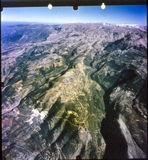
Qurnat as Sawda'
| dc.contributor.author | Unknown | |
| dc.date.accessioned | 2019-10-10T14:48:31Z | |
| dc.date.available | 2019-10-10T14:48:31Z | |
| dc.date.issued | 2000 | |
| dc.identifier.uri | http://crdp.ddns.net:8080/xmlui/handle/123456789/3005 | |
| dc.description | Qurnat As Sawda' (black peak) in Jabal al-Makmel is the highest point in Lebanon and the Levant, at 3,088 meters above sea level. | en_US |
| dc.language.iso | en | en_US |
| dc.publisher | CRDP | en_US |
| dc.relation.ispartof | Geography for all levels | en_US |
| dc.rights | All Rights Reserved to the CRDP | en_US |
| dc.subject | Qurnat as Sawda' | en_US |
| dc.subject | Nature | en_US |
| dc.subject | Snow | en_US |
| dc.subject | Geography | en_US |
| dc.subject | Geography Of Lebanon | en_US |
| dc.subject | Lebanon | en_US |
| dc.subject | Middle East | en_US |
| dc.subject | Photography | en_US |
| dc.subject | Aerial View | en_US |
| dc.subject | Mid-Air | en_US |
| dc.subject | Landscape | en_US |
| dc.subject | Mountain Range | en_US |
| dc.subject | Sky | en_US |
| dc.subject | Levant | en_US |
| dc.subject | Highest Peak | en_US |
| dc.subject | Above Sea Level | en_US |
| dc.subject | Jabal Al-Makmel | en_US |
| dc.subject | Hiking | en_US |
| dc.subject | Tourism | en_US |
| dc.subject | North Of Lebanon | en_US |
| dc.subject | Black Peak | en_US |
| dc.title | Qurnat as Sawda' | en_US |
| dc.type | Image | en_US |
| dc.type | Photograph | en_US |
| dc.type | Clipart | en_US |
| dc.type | Raster | en_US |
Files in this item
This item appears in the following Collection(s)
-
Geography [328]
Collection of images appearing in Geography books.

